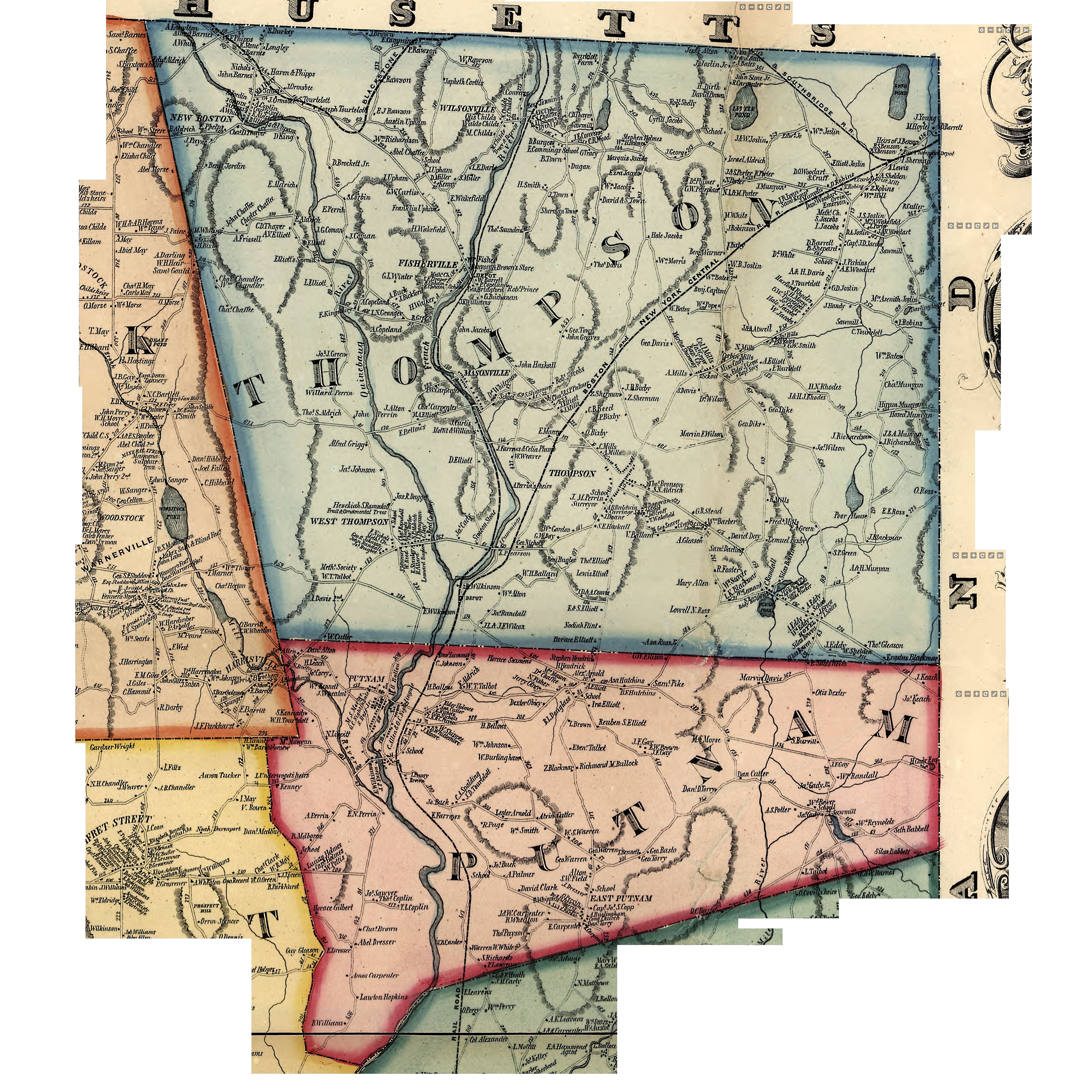
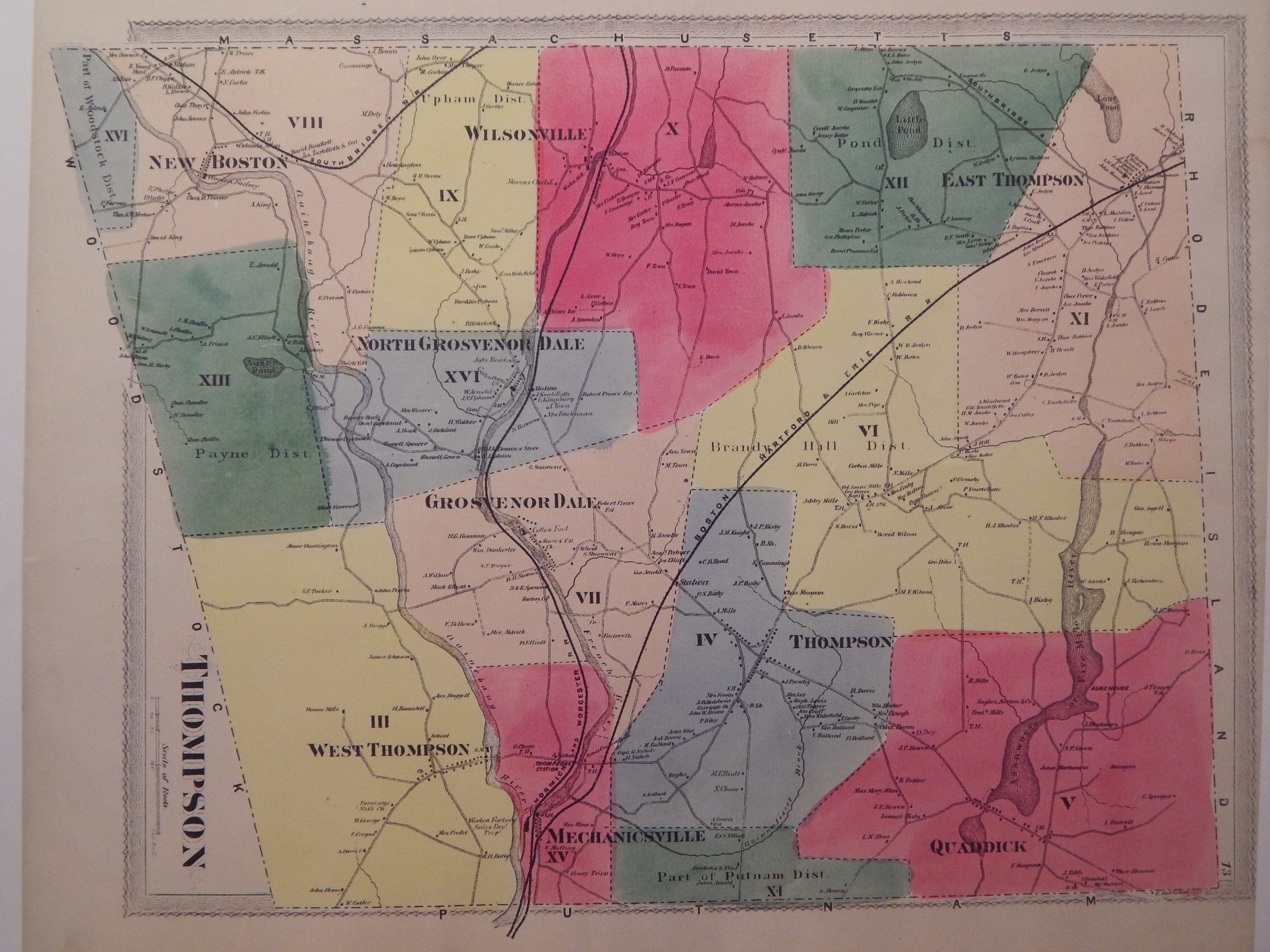
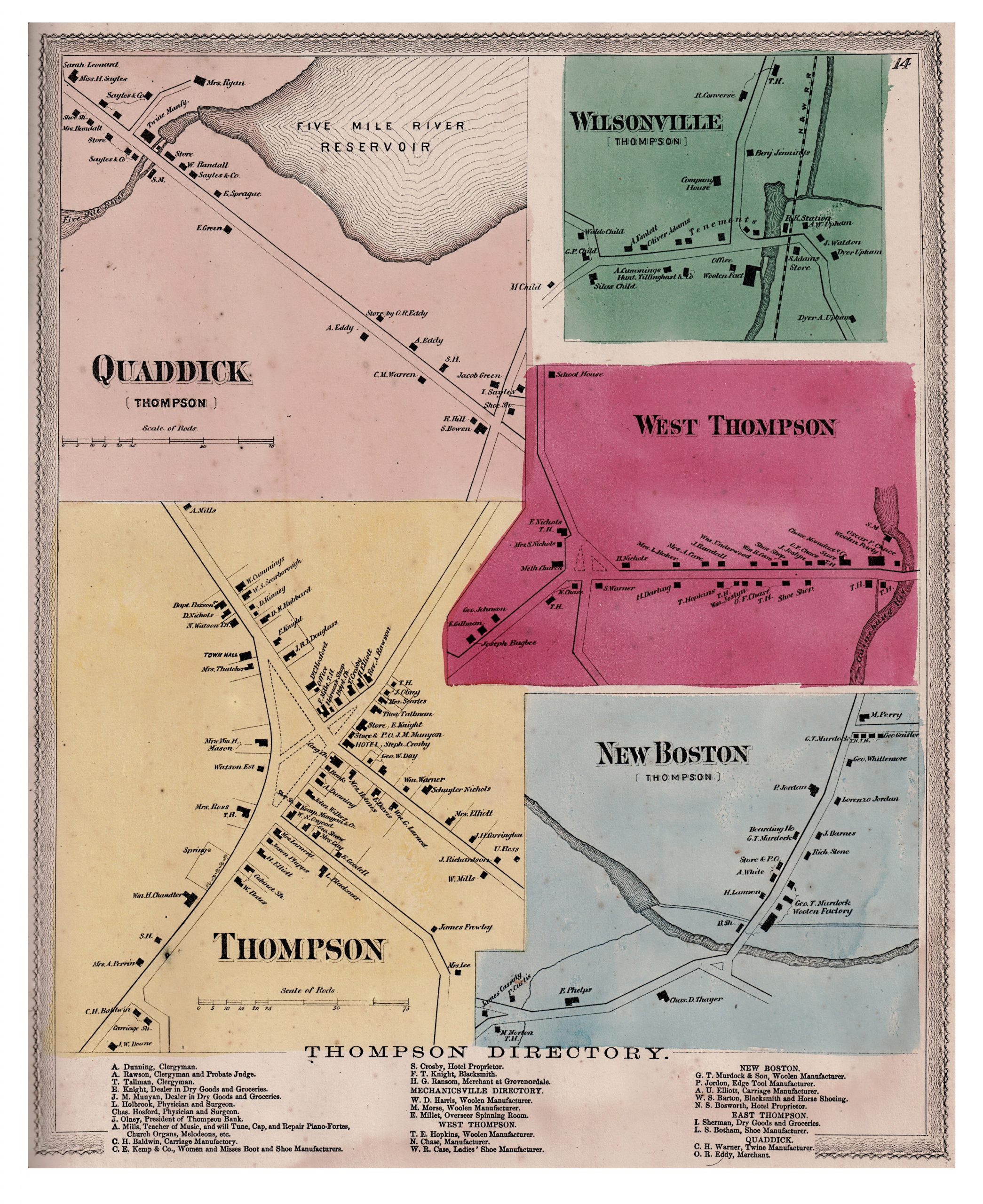
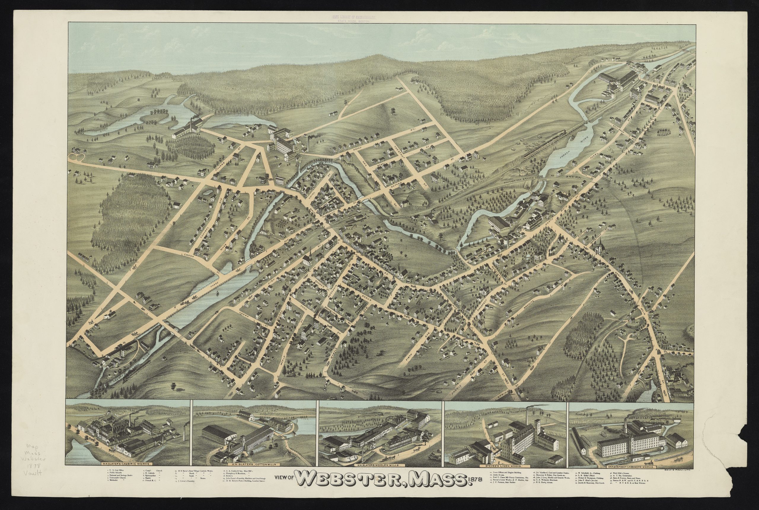
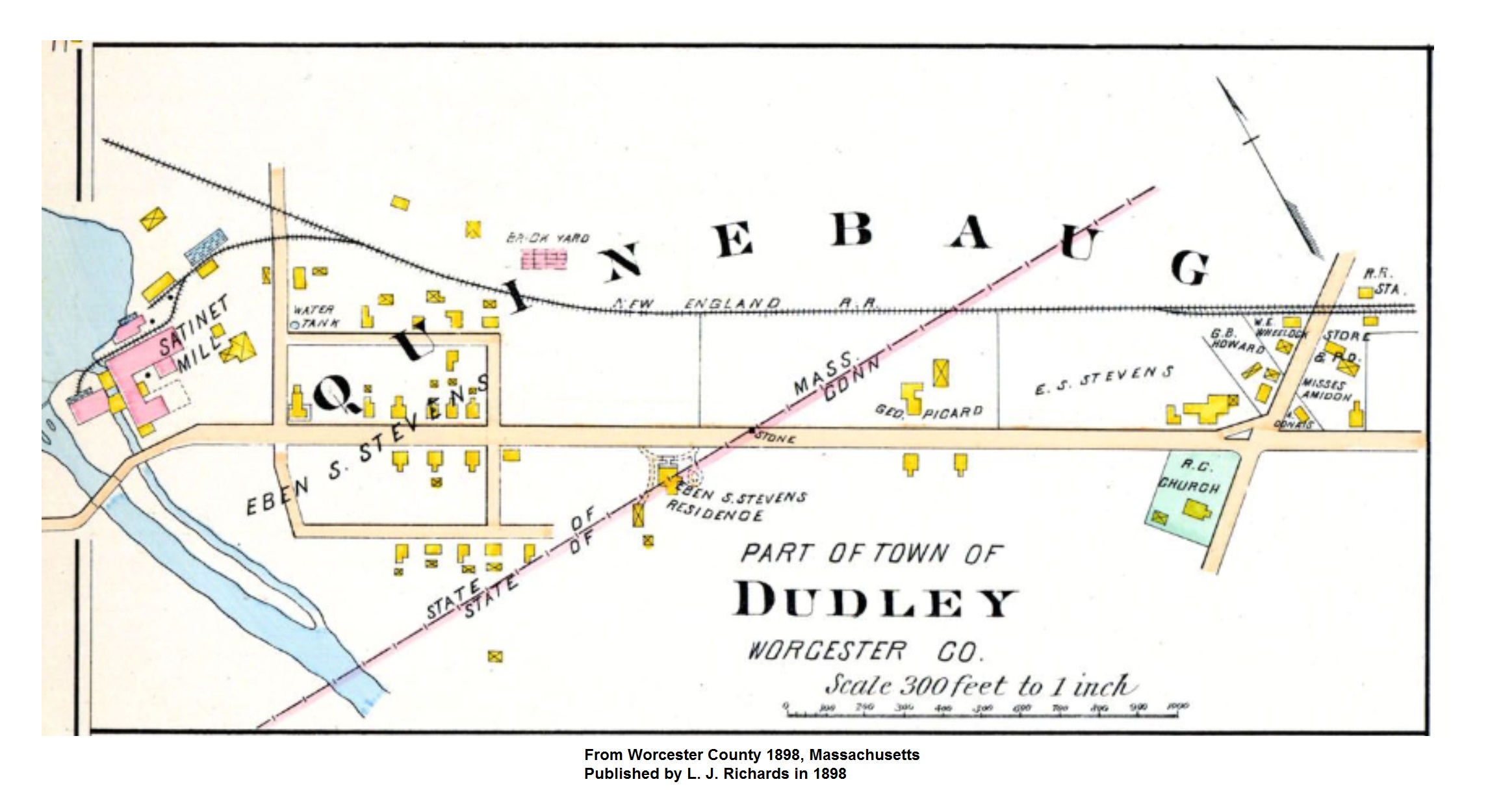
Maps 1797 Connecticut MAP 1832 William Lester Map 1856 Map of Windham County 1856 Map of Thompson and Putnam 1869 Thompson Map 1869 Thompson 5 Villages Map 1878 Webster Map 1880 – 2022 Topo-View Maps 1883 Woodstock map – w/Thompson areas of interest 1898 Quinebaug – Dudley Map 1934 Thompson Aerial Map 1965 Thompson Aerial Map 2016 Connecticut High Resolution Aerial Map 2016 Connecticut LIDAR elevation Map